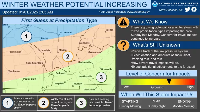
The National Weather Service says the chance that Western Kentucky will receive some significant winter weather is increasing.
National Weather Senior Meteorologist Derrick Snyder says the timing looks the winter weather could begin Sunday morning and afternoon, with the worst of the storm Sunday night, and winding down Monday morning. Snyder says while it’s still too early to determine specific forecast amounts, forecasters are getting a better idea what the predominant precipitation types will be.
As is typical with winter storms in our region, a good part of the area will be in the “battle zone” between different precipitation types (snow, freezing rain, sleet, and plain rain). This means significant accumulations of snow, sleet, and freezing rain are all possible, and we are getting more confident that we will see travel impacts even if we are not sure what type of precipitation will occur just yet.
With the potential for significant freezing rain accretion, we are also becoming more concerned there may be a corridor that receives enough freezing rain to cause tree and power line damage as well. After the storm winds down, a wave of bitterly cold Arctic air will arrive for much of next week. Low temperatures in the single digits and teens are possible, as well as wind chill values near or below 0°F. If we do have power outages, this could become a very serious situation.