The National Weather Service says Western Kentucky could experience heavy rainfall and some strong thunderstorms Monday night and early Tuesday morning.
According to the Paducah office of National Weather Service another round of thunderstorms with locally heavy rain is expected to develop Monday through Tuesday. Heavy rain and possibly some flooding is possible.
Severe weather is also possible, although instability appears limited for now but shear is strong enough it will require monitoring. Thunderstorms may linger into
Tuesday across parts of west KY and southwest Indiana. Strong/Gusty winds will also be possible overnight Monday into Tuesday.
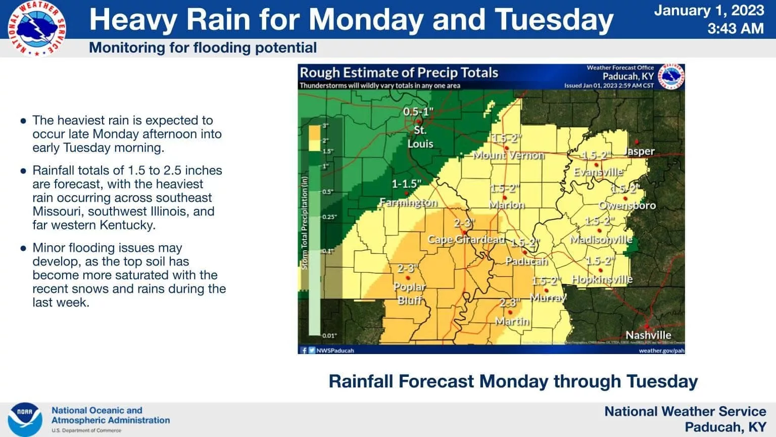
The heaviest rain is expected to occur late Monday afternoon into early Tuesday morning. Rainfall totals of 1.5 to 2.5 inches are forecast, with the heaviest
rain occurring across southeast Missouri, southwest Illinois, and far western Kentucky. Minor flooding issues may develop, as the top soil has become more saturated with the recent snows and rains during the last week.
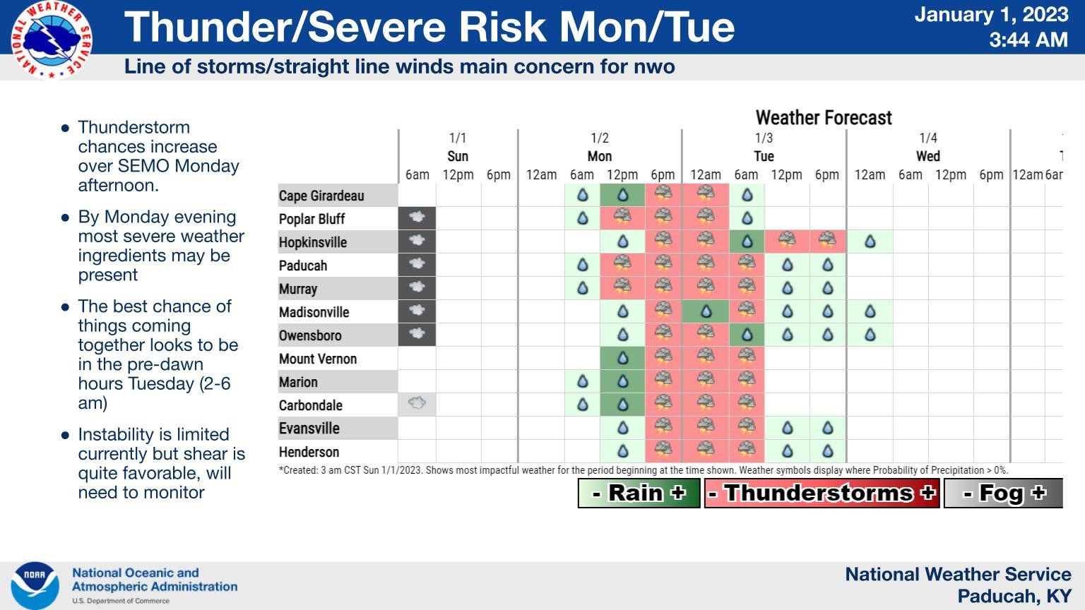
Thunderstorm chances increase over SEMO Monday afternoon. By Monday evening most severe weather ingredients may be present. The best chance of
things coming together looks to be in the pre-dawn hours Tuesday (2-6 am).
Your Weather Edge will monitor the forecast and any issues that arise Monday night and Tuesday morning.