The extreme heat will continue to begin the week, however there is relief in sight by the weekend as the hottest stretch of weather in three years comes to an end.
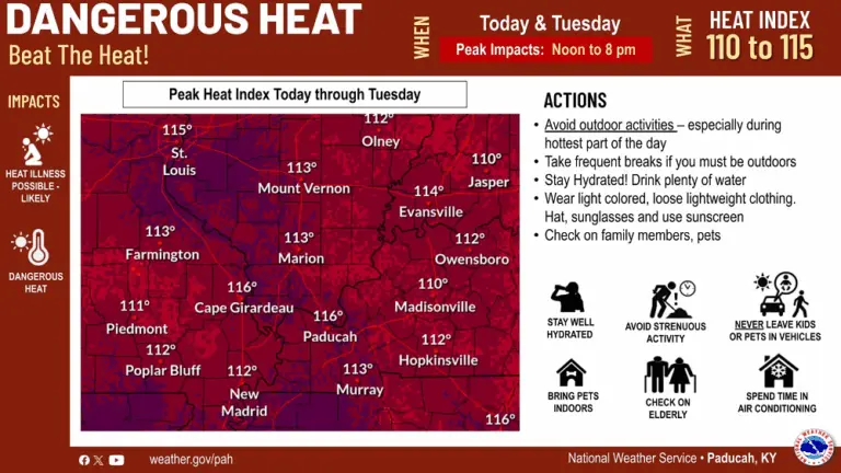
An extreme heat warning is in effect through 8:00 Tuesday night as heat index readings could reach 115 Monday and Tuesday. Meteorologist Sean Poulos says an extreme heat watch will take over Tuesday night through Wednesday evening as a chance of showers Wednesday could bring some relief.
click to download audioPoulos says the weekend cool down could give us our lowest temperatures since mid-June.
click to download audioThe Mesonet has recorded nine days in July with a temperature at 90 degrees, but none have topped 95. Three years ago, we recorded 22 days in July above 90 with nine above 95 and two over 100.
The difference this year has been the elevated dew points due to increased ground moisture.
July has produced 13 days with the average dew point above 75 degrees, which weather officials call oppressive. There was only nine such days last summer and five days in 2022.
Poulos says the dew point readings are reaching a record for longevity.
click to download audioHe adds the upcoming decline in dew point temperatures will be the result of fronts moving through the area more than a reduction in ground moisture.
click to download audioFor the next three days, the risk of heat-related illnesses, such as heat exhaustion and heat stroke, are still possible, especially for young children, the elderly, and people with chronic medical conditions.
They recommend you avoid outdoor activities during peak afternoon hours, drink plenty of water to stay hydrated, and spend time in air-conditioned places