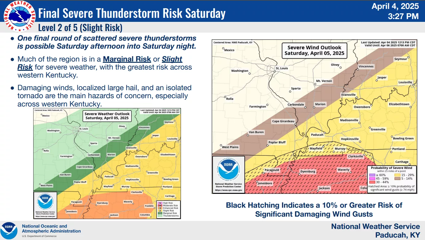
Weather forecasters say a third round of severe storms Friday night will be similar to the system that passed through on Wednesday.
Senior forecaster Justin Gibbs says the moist unstable air could produce severe weather with EF-2 tornadoes possible.
Gibbs also says another five inches of rain is possible with the system that will continue bringing rain through Saturday night.
Entering Friday night, less than an inch of rain was needed in Trigg and Christian counties to set a new three-day record for rainfall. Caldwell and Todd counties were about three inches shy of setting new two-day records.
Hopkinsville and Cadiz are seeing some flooding issues due to the Little River, which reached near record crests earlier Friday and will continue to rise with the latest round of storms.
Gibbs says if the flood waters continue to rise, the National Weather Service may issue the rare flash flood emergency.
The timing of Friday night’s storms has it reaching the lakes area of western Kentucky between 10:30 and 11:30.