There seem to be a lot of things going on across the region this spring. The New Madrid Fault keeps rumbling and fraying the nerves of those living near the Mississippi River. We have seen late freezing conditions causing damage to some crops and fruit trees. Then to the other extreme, we have had several tornadoes already recorded. Thankfully, none of them were real strong.
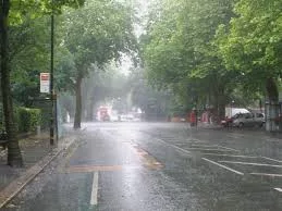
On top of that, even though it seems like we have seen a lot of rain, we continue to run below normal for rainfall this year. I t has improved some in the past week or two.
We are at around 3.82 inches below normal, down from almost 6 inches below normal a couple of weeks ago. Now it looks like we will get a taste of summer as we get into the first of May. The summerlike pattern will be brought on by a northward bulge in the jet stream. The jet stream is a river of air at the level in the atmosphere where jets cruise. So let’s take a look at what may be in store for us during the rest of spring and early summer.
At Louisville, Ky. workouts for the 2017 Kentucky Derby have begun. Highs will trend upward from the 70s to the upper 80s to near 90 as we start into the first week of May.  The Derby race will be held on Saturday, May 6. If long range trends continue to hold true, cooler, more seasonable air may arrive by then with dry weather. This would probably be called “Blackberry Winter” since the blackberries should be starting to bloom around that time. But, we may have to deal with severe storms leading up to the 6th…probably around the 4th. Timing will be the key. This very well may be the pattern for the month of May. Periods of warmth, almost hot temperatures, followed by quick cool air intrusions with severe storm potentials in between. This would mean heavier rainfall, with an abundance of severe weather all the way into early June. Looking even further ahead, there are signs that the summer months of June through August will turn a little hotter than usual and have a tendency to be dry.
Overall, there is expected to be more widespread heat and humidity over the nation this summer. July looks typically hot, but the humidity will help fire a few afternoon thunderstorms throughout the month. One more important thing concerning our future weather is the formation of a weak El Niño. El Niño began affecting the world’s weather in 2015 and ended barely a year ago. Typically, El Niños occur three to seven years apart, but dramatic winter flooding in California followed by unprecedented rains that buried Peru in deadly mudslides may be a sig nal that El Niño is returning. We’ve just had an El Niño and that has actually taken some heat out of the tropical Pacific Ocean. So, in that sense, there is less fuel available for the next one. That being said, conditions are very seldom ‘average’ in the tropics. It's really always going from El Niño to La Niña — which is the cool phase in the tropical Pacific — and back again.
The average period of this cycle is around three to seven years. So, having another one almost a year after the previous one is fairly unusual, but not unprecedented. But if…and that is a big “if” we go into next fall and early winter with a weak El Niño, it would spell a colder and snowier early winter as opposed to the non-winter we just had. Now, having said all this, remember, these are long range trends based on several sources. They are certainly not written in concrete. As I said, they are trends that may give us a clue as to what we may expect. But the degree of accuracy certainly drops the further into the future you look. In future posts, I will give you some pointers on how to get prepared for any natural disaster. Feel free to leave comments and be sure to hit the “Like” button at the bottom of this post.


