Several changes have prompted me to update my thoughts on the very long range outlooks into late fall and early winter. At this time I will look at the outlook through December and save the winter and early spring outlooks for a future update.
My last long range outlook was posted on August 13, 2016. To check my accuracy so far, I spoke about September. Here is what I said…“There will still be days in the first half of the month when the highs may hit near 90 but those days will come less frequently and the humidity shouldn’t be too high. By mid-month, the 90’s should be only a memory.” Okay…so far so good. While the temperatures are cooler, the fall type weather doesn’t seem to have much staying power. 
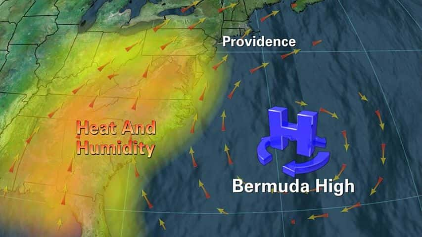
The problem with the warm temperatures all summer has been an unusually strong “Bermuda High” off the southeastern coast of the U.S. Anytime the Bermuda High sets up, we get hot and humid weather in our region. As long as this remains in place, the permanent transition to fall will be delayed. But there are signs the Bermuda Heat Ridge is starting to breakdown. Two things are working on breaking it down.
First, a constant onslaught of cold fronts keep hitting up against it now and are helping to push it back eastward. The next thing that will tear it down is the tropical disturbances out in the Atlantic. One of them has become Tropical Storm Ian. If one gets into the Gulf, it will pretty much end the Bermuda High’s influence. By the time the last  week of September arrives, it will be getting progressively colder with each cold front. It looks like the change to fall will be complete and much cooler temperatures will prevail.
As October arrives, the 80’s will be pretty much gone and highs will average in the low to mid 70’s. There are indications that an impressive autumn storm will hit the region around October 13th, give or take a couple of days. This will lead to even cooler conditions with highs in the upper 60’s through the end of the month. Another big storm around the first few days of November will drop temperatures into the 50’s through at least the first half of November, maybe even colder around Thanksgiving. Here is what I said back in August on this period of time…” Cold shots are predicted to arrive by the middle to late November, just in time for Thanksgiving. The cold air could allow some snow to fall in late November providing the La Nina remains weak.” Overall, the month of November looks pretty unsettled. A sign of things to come.
Now, the final piece of the puzzle, the La Nina. Here is what I said in August…” The models continue to waffle back and forth on how strong the La Nina may become. Or it may even be nonexistent. The weaker the La Nina, the more likely our region will be colder and snowier this coming winter. That is what I am thinking will happen. A very weak La Nina will probably lead to colder and snowier times ahead.” Over the last few days, NOAA canceled the La Nina watch that was in effect. They now say only a 40% chance of seeing a La Nina develop this winter. Any presence of a La Nina this winter is going to have a very large effect on how our winter shapes up.
I still believe it will be weak to non-existent and our outlook for winter is for much colder and snowier than usual. I also look for a visit or two from the Polar Vortex like we had a couple of years ago. The polar vortex actually is a seasonal atmospheric phenomenon, a system of strong, high-level winds — called the jet stream — surrounding an extremely cold pocket of Arctic air. Its winds usually form a boundary that keeps the cold air contained and prevents us from freezing.  The problem, though, is that once in a while, the polar vortex breaks down a little.
The result is a big, powerful blast of Arctic air that can travel far south, causing the temperature to plunge in places accustomed to having mild winters. Now having said all this, it looks like our first chance of frozen precipitation will come sometime between Thanksgiving and December 4th. Now, I still must caution you to take all this with a grain of salt. Yes, it is based on trends and strong signals on what may be expected. But nothing in weather is exact and is subject to change. Feel free to leave comments and be sure to hit the “Like” button at the bottom of this post.


