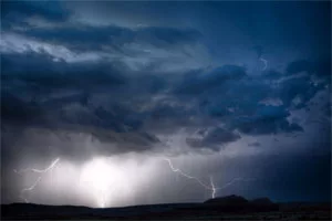
I have been absent from the blog for a couple of days due to the severe threats occupying much of my time. We will soon get back into the severe threat with storms arriving this weekend. This seems to be a stronger and larger storm system than what we have been experiencing.
 It looks like the day that is more likely to see severe storms will be Sunday, May 1st. Can you believe we are already starting into May? So far, our severe season hasn’t been anything very eventful overall. But there are signs that several severe events may sweep across the western Kentucky region during the month of May. As we get into the first week of May, a strong cold front should sweep through by Wednesday the 4th. This will drop temperatures into the upper 60’s for highs and upper 40’s for lows.
As I look out into the long range and the satellite images, I see no less than 5 storms that are lined up to come into the west coast and eventually into our region. The first arrives here this weekend, the second around the 4th, and an impressive storm somewhere in the May 6th through the 8th time frame. If that one occurs as it looks like, it will create a coolish and very wet Derby Day and Mother’s Day as well. There may also be a round of severe weather in there somewhere as well. Look for periods of storms all the way through mid-May. I will be watching for the subtropical jet stream to start to lift northward in coming weeks. Currently, it is suppressed well to the south. As it lifts north and links up with the disturbances coming off the Pacific, we can expect an uptick in rain and severe chances.

Remember back to 2011 and the super tornado outbreaks? Joplin, Mo. and Birmingham, Ala. were just a couple of places among many that were hit by tornadoes…including our region. That was a similar setup to what may be about to form in coming months. It had been an El Nino the previous summer that was followed by a La Nina in 2011. This El Niño reached a peak in ocean temperatures in November and those waters have been cooling off ever since, following the normal progression. That decline means it’s almost a certainty that the tropical Pacific Ocean is going to go back to neutral temperatures.
What’s still up in the air is whether it stays neutral or continues to cool until it reaches a La Niña state. If a La Niña is in the offing, those waters should be cooling further by mid-summer, though, like El Niño, it wouldn’t peak until late fall or early winter. If that occurs, we can expect next spring’s severe season to be horrific. We should have a better idea of the potential strength by August, possibly a bit sooner if there is a very sharp cool down in Pacific Ocean temperatures. As I have always said in weather, nothing is certain. These things I have posted are just the trends as they seem to be developing. We will see how they play out. Feel free to leave a comment and please be sure to hit the “Like” button at the end of this post.


