


WEATHER – DAVID POWELL
 The latest up to date weather information from the area’s weather guru. Plus, it’s your chance to talk to him about the weather and ask him the questions that are on your mind.

A warming trend commences Friday, returning us to well above normal temperatures by this weekend, with highs from the middle 70s to near 80

We start our Monday with a Wind Advisory in effect from 5 AM today through 5 AM Tuesday. Southeast winds at 20 to 35

Today will be mostly cloudy with an increasing chance for showers as the day wears on. Highs will be in the upper 60’s. A
Hey everyone, the weather continues to change back and forth on what we can expect as a strong cold front approaches this evening. The
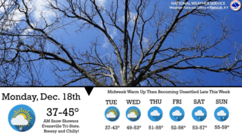
Gusty northwest winds will pick up Monday afternoon and evening and bring with it much cooler temperatures before a midweek warm-up. Tweet Share Reddit
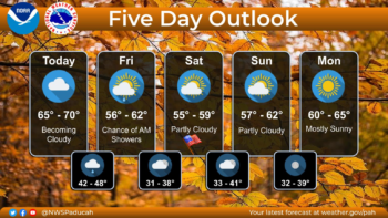
Highs struggling to get into the 60s is the forecast for this weekend. Tweet Share Reddit +1 Pocket LinkedIn
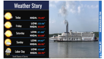
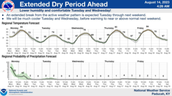
As we dive into Labor Day weekend, the thermometer will show some warmer temperatures and no chances for precipitation. Tweet Share Reddit +1 Pocket
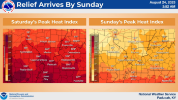
A cold front making its way through western Kentucky Friday night will start to bring some much-needed relief from the dangerous heat we’ve experienced
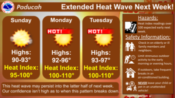
September-like temperatures will stick around through Saturday, before heat and humidity return at the beginning of next week. Tweet Share Reddit +1 Pocket LinkedIn
After rain and storms through the weekend, sunshine will prevail through the upcoming week. Tweet Share Reddit +1 Pocket LinkedIn
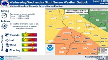
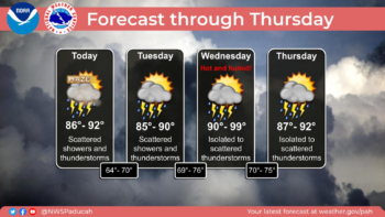
The National Weather Service in Paducah says that two rounds of severe weather are possible Wednesday. Tweet Share Reddit +1 Pocket LinkedIn

After a rainy Thursday, the forecast continues to call for a daily chance for showers and storms through the weekend. Tweet Share Reddit +1

A round of severe thunderstorms knocked down some trees and dropped the temperature by at least ten degrees across the region Saturday night. Tweet
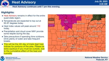
A Heat Advisory remains in effect until 7:00 Saturday night across western Kentucky with a chance for showers and storms by late afternoon. Tweet
Weekend showers and storms are continuing to improve drought conditions across the region and more rain is possible throughout the week. Tweet Share Reddit
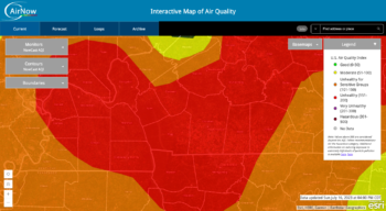
Smoke from wildfires in Canada is again causing an Air Quality Alert across portions of western Kentucky and middle Tennessee Monday. Tweet Share Reddit
Saturday’s rainfall may have helped with the region’s drought conditions, but for some in western Kentucky, the risk of fire still exists. Tweet Share
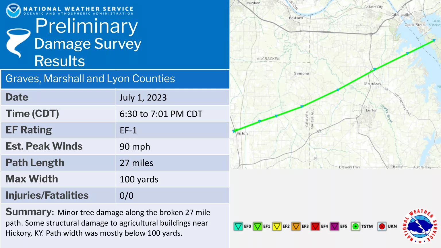
The National Weather Service in Paducah confirmed an EF-1 tornado tracked through portions of Graves, Marshall, and Lyon counties Saturday evening. Tweet Share Reddit
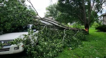
Severe storms Friday afternoon and evening caused several thousand electric customers to lose electricity and downed some trees. Tweet Share Reddit +1 Pocket LinkedIn
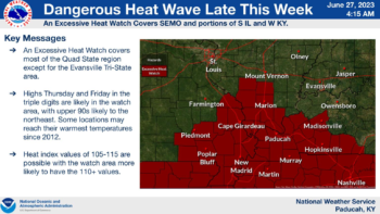
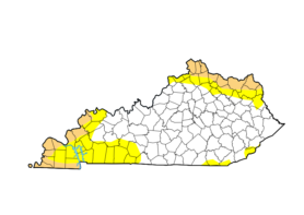
An Excessive Heat Watch has been issued for portions of western Kentucky from Thursday morning to Friday evening. Tweet Share Reddit +1 Pocket LinkedIn