The National Weather Service in Paducah says the winter storm system that is approaching the region may not produce as much of a threat as initially thought.
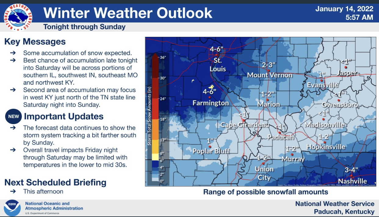
The National Weather Service says they continue to monitor a winter weather system forecast to affect the area tonight through Sunday. Considerable uncertainty remains with respect to snowfall. The trend in the forecast data is for lower snow amounts. But that could still change.
The first round will be tonight into Saturday, as a transition from rain to a mix, and then snow is forecast to occur from north to south across the four-state region. Some areas in southern
Illinois, southwest Indiana, and southeast Missouri could see 1 to locally 2 inches of snow. However, much of this may be confined to grassy, elevated surfaces, as temperatures are forecast to be in the lower to mid-30s. Impacts on travel may be minimal. But a few slick spots cannot be ruled out.
For Saturday night through Sunday, the snow chances shift south. The National Weather Service says they cannot rule out a couple of inches of snow, and some travel impacts from the Land Between the Lakes area east to Hopkinsville. Meanwhile, for the Purchase area of west Kentucky into the southern tip of Illinois, west toward Sikeston, Missouri, there may not be much in the way of snow accumulation with this storm system. But that could change if the storm track shifts. Continue to monitor the forecast closely today and this evening.
The National Weather Service has issued a Winter Storm Watch for Montgomery and Stewart Counties in Tennessee, with no watches issued for Western Kentucky at this time.
Your Weather Edge will continue to monitor forecasts from the National Weather Service and provide updates throughout the weekend.