The region is now under a Winter Storm Watch Tuesday night through Thursday.
Weather Edge forecaster David Powell says arctic air that was expected to impact the region last weekend will linger in the area this week.
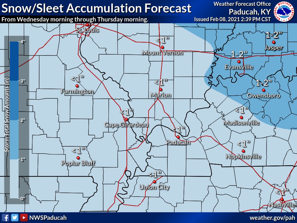
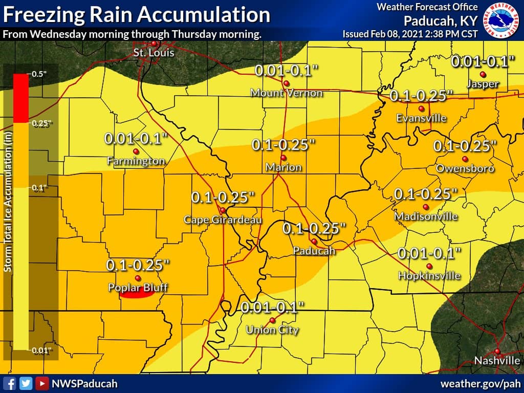
Precipitation will begin Monday night, but the best chance for wintry precipitation will be Tuesday night into Thursday. The National Weather Service in Paducah says the area could see up to two inches of snow and up to a quarter-inch of ice accumulation. Most of the wintry precipitation is expected to hold off until Wednesday afternoon for the Pennyrile region.
Powell adds whatever falls Tuesday night could melt away Wednesday.
Powell says as we head toward the weekend, some of the season’s coldest temperatures are expected.
For more on the weather, visit the Weather Edge blog here. Your Weather Edge will also keep you updated with forecasts on-air.