


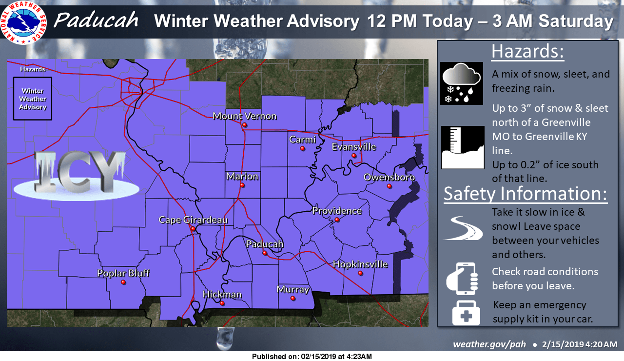
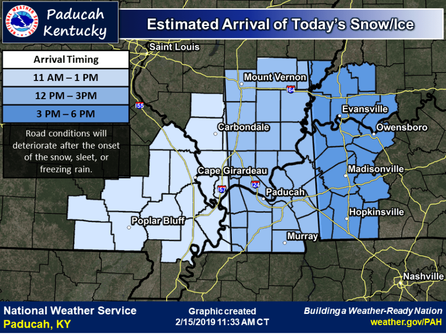
The National Weather Service in Paducah has issued a Winter Weather Advisory in effect from noon today until 3:00 Saturday morning as mixed precipitation moves into western Kentucky.
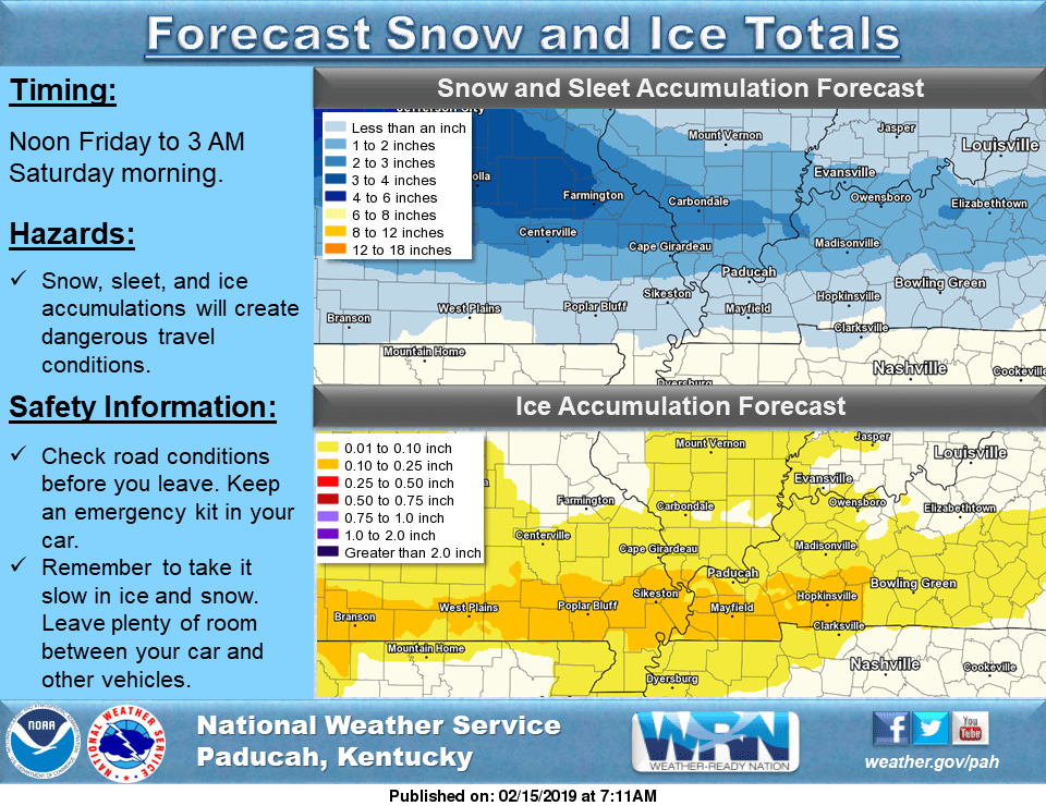
Meteorologists say total snow and sleet accumulations of up to three inches are expected generally along and north of a line from Greenville, Missouri to Greenville, Kentucky. Ice accumulations averaging around one-tenth of an inch are expected in Kentucky counties bordering the Tennessee state line.
Motorists should plan on slippery and hazardous road conditions that could impact the afternoon and evening commute home from school and work. Meteorologists say travel conditions will deteriorate during the evening the hours. Bridges, elevated surfaces, and untreated roadways will tend to freeze first. And remember, even very small amounts of ice can produce very dangerous driving conditions.
Weather Edge Forecaster David Powell says another system is forecast to move in Saturday night and that could result in some snow.
right-click to download mp3
To keep up with all the latest weather, follow Your Weather Edge on Facebook.
WebReadyTM Powered by WireReady® NSI