


Planning on travel this holiday season? You are not alone. Since 2005, total year-end holiday travel volume has grown by 21.6 million, an increase of more than 25 percent.
Airfare and hotel rates are trending cheaper, while car rentals and gas rates are more  expensive this year. Travelers should plan to arrive at the airport at least two hours prior to the scheduled departure of their flight. It may be necessary to arrive even earlier,” AAA spokesperson Jeanette Casselano said. Before hitting the road, make sure your vehicle is ready for wintry conditions.
Monitor tire pressure, test the battery, replace windshield wipers and make sure all headlights and brake lights are in working condition. In case of an emergency, be prepared by keeping a cell phone and charger with you at all times. Carry an emergency kit with a flashlight, jumper cables, a first-aid kit, sleeping bags, gloves, a battery-powered radio and extra water. So why all the precautions? Because on Friday Dec. 22nd, moderate to heavy rains will overspread the state.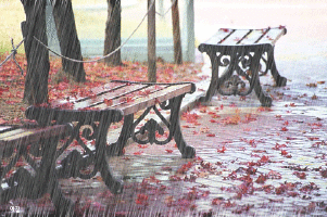 This is ahead of a massive cold air outbreak that will bring some of the coldest air so far this season to Kentucky. By overnight Friday, the rain is expected to possibly mix with and/or change to a wintry mix that continues into Saturday morning.
However, the cold air will hang back just a bit on Saturday as that front then slows down over the weekend, with another wave or two of low pressure developing along it. But I have to tell you that the air behind the front is frigid and will bring some of the coldest air of the season. The big question leading up to Christmas will be where the cold and warm air masses clash. The battle zone is expected to set up across the 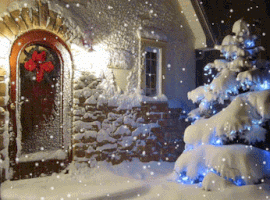 south-central U.S. including near our region, to the Great Lakes and interior Northeast over the weekend and through Christmas Day. While it is not in the forecast just yet, there could be a significant storm system that forms near this boundary.
You have to remember, that this system is still many days out and there will be changes to the forecast. A look at the models show a wide of range of possible solutions, so it`s still anyone’s guess on what will happen. Right now, snow is expected to develop on Christmas Eve afternoon and continue into the overnight. It currently doesn’t look like a big snow maker but it may be just enough to give us our white Christmas. A white Christmas in the U.S. is defined as having an inch or more of snow on the ground at 7 AM on the morning of Dec. 25.
As I said earlier, we still could get more or less snow than forecast and we proba bly won’t know for sure until the storm is upon us. By Christmas Day, the Arctic air straight out of Siberia will take over the weather picture with significantly colder temperatures that lasts through the middle of next week. Highs on Christmas Day will probably stay in the upper 20’s with lows in the low teens…possibly single digits. But more trouble lurks on the horizon. By around the 28th or 29th, a large storm system will try to overrun the cold air in place. At first this looks like a big snow maker is possible. But if the cold air relaxes a bit and gets shallow, then the dreaded ice storm wording may return to the forecast.
But again that is so far out, I wouldn’t get too worried just yet. As we get into January, I would watch Jan 2nd and January 7th for other storms with snow potential. After that, look for the mid-January thaw to take hold leading up to the 20th. Then a big storm on the 28th give or take a day or two. Whatever you do over the holidays, travel safe and well. Be sure to remember why we celebrate Christmas. Merry Christmas everyone. . Feel free to comment on this post and be sure to hit the “Like” button at the end.