


A terrifyingly powerful Category 4 Hurricane Michael was poised to become the strongest hurricane to hit the Florida Panhandle in recorded history Wednesday, its rapid strengthening catching some by surprise. Anxious officials are telling those who didn’t evacuate it’s too late now. It’s time to hunker down. Most areas are out of gasoline and supplies. All they can do now is to pray and wait.
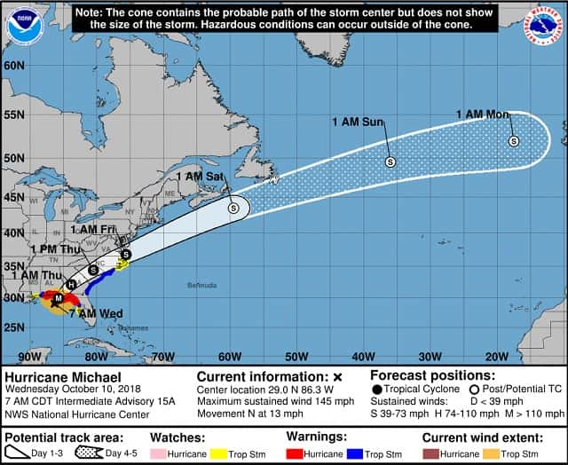
Reports from an Air Force Reserve Hurricane Hunter aircraft indicate that Michael has continued to strengthen during the past several hours. At 700 AM CDT, the eye of Hurricane Michael was located near latitude 29.0 North, longitude 86.3 West. Michael is moving toward the north near 13 mph. Additional strengthening is expected before landfall as Michael remains over warm water and in an environment of light to moderate vertical shear. Michael is likely to produce potentially catastrophic wind damage where the core of the hurricane moves onshore in the Florida Panhandle, and everyone in the hurricane warning area should prepare for life-threatening hurricane winds.
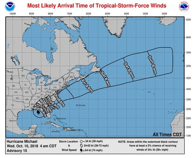
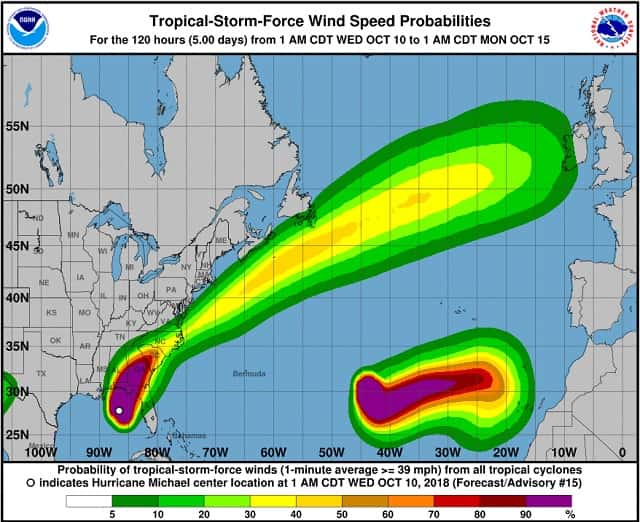
Dangerous hurricane-force winds will also extend well inland across portions of the Florida Panhandle, southern Georgia, and southeast Alabama as Michael moves inland. After landfall, Michael is expected to steadily weaken as it crosses the southeastern United States. Tropical storm conditions are expected to reach the hurricane warning area during the next few hours, so all preparations should be rushed to completion. A turn toward the north-northeast is expected later this morning, with a turn toward the northeast expected this afternoon or tonight. A motion toward the northeast at a faster forward speed is forecast on Thursday and Friday. On the forecast track, the eye of Michael is expected to move ashore over the Florida Panhandle later today, move northeastward across the southeastern United States tonight and Thursday, and then move off the Mid-Atlantic coast away from the United States on Friday.
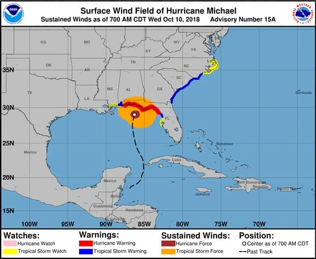
Reports from an Air Force Reserve Hurricane Hunter aircraft indicate that maximum sustained winds have increased to near 145 mph with higher gusts. Michael is an extremely dangerous category 4 hurricane. Some additional strengthening is possible before landfall. After landfall, Michael should weaken as it crosses the southeastern United States. Hurricane-force winds extend outward up to 45 miles from the center and tropical-storm-force winds extend outward up to 185 miles. A wind gust to 56 mph was recently reported at Apalachicola Regional Airport.
Tropical storm conditions are spreading onshore along the U.S. Gulf Coast within the warning area, with hurricane conditions spreading onshore later this morning within the hurricane warning area. Hurricane conditions will also spread well inland across portions of the Florida Panhandle, southeastern Alabama and southwestern Georgia later today and tonight. Tropical storm conditions are expected to spread northward within the warning area along the southeast U.S. coast beginning tonight, and are possible in the watch area by late Thursday and Thursday night. Michael is expected to produce heavy rainfall amounts in the Florida Panhandle and Big Bend, southeast Alabama, and portions of southwest and central Georgia…amounts of 4 to 8 inches, with isolated maximum amounts of 12 inches. This rainfall could lead to life-threatening flash floods. The remainder of Georgia, the Carolinas, and southern Virginia are expecting 3 to 6 inches, with isolated maximum amounts of 8 inches. This rainfall could lead to life-threatening flash floods.
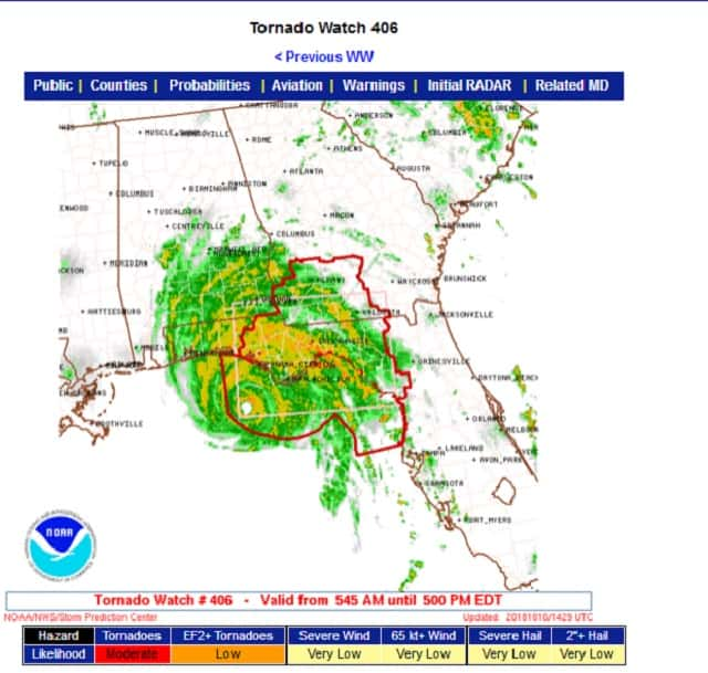
A few tornadoes will be possible across parts of the Florida Panhandle and the northern Florida Peninsula through this afternoon. This risk will spread into parts of central and southern Georgia and southern South Carolina this afternoon and tonight.