


High pressure takes over the weather across the South for this week, leading to a long stretch of summery warmth and humidity. We won’t see a lot in the way of rain through Friday at least. But we will see heat with highs in the upper 80’s to near 90. Things start to change next weekend when a front will move into the southern Plains. It will be a slow-mover, so we will likely see areas west of the Mississippi getting a lot of rain next weekend and the first part of the following week. From there, what happens around here may largely depend on what happens in the tropics.
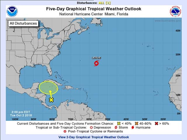
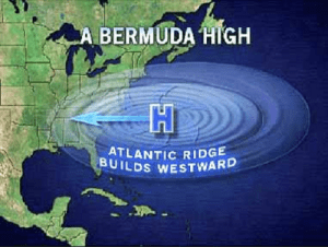
Many of the models slowly bring the western trough toward the east, with a tropical system trying to form in the Caribbean. Areas from near Jamaica to Cuba, Hispaniola, the Bahamas and the Florida Peninsula are in the swath where development into a tropical depression or storm could take place later this weekend into next week. If it becomes a tropical storm, the next name on the list of storms for the 2018 Atlantic hurricane season is Michael. There are a lot of variables on what happens next so my confidence level on what may happen is a little lower than usual. Farther north, Leslie is forecast to become the Atlantic’s next hurricane while making a loop over the middle of the basin and well away from any land areas at this time. One reason I mention this is because the heat and humidity we are experiencing is due to a ridge of high pressure known as the “Bermuda High” located off the southeast coast of the U.S. The tropical systems are helping to hold it in place…even expanding it instead of allowing it to move further east. The result is the summer-like weather we have been having.
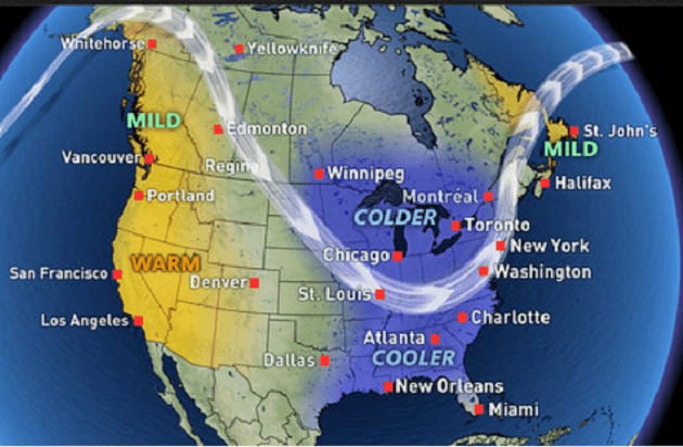
 Fall is a season of transition in which we expect frequent pattern reversals with wild swings in temperatures. However, the past five weeks have featured a persistent pattern with only brief interruptions as warmer than normal temperatures have dominated across eastern U.S. and colder than normal temperatures have been across most of the Northwestern quadrant of the U.S. A pattern change will be set in motion early next week as a deep trough in the jet stream digs into central North America. The question is how far south and east will this initial push of cold air get? There is a massive amount of cold air in Canada and the snowpack in the Rockies and southern Canada is starting to build. This will be an important player in our weather as winter approaches. If you are a snow lover, you like to see the increased snowpack.
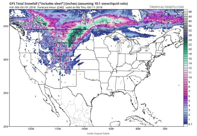
This pattern change will affect the northern plains along with much of the central U.S. and will open the door for a cold northwesterly flow out of the Arctic, sending temperatures below seasonal values. A second, re-enforcing shot of cold air will drive temperatures even lower late in the week and next weekend. I still expect this to affect our region although some models hold the air back until around the 15th or 16th of October. We’ll see. The dramatic swing in temperatures will be driven by an amplified jet stream – characterized by deep troughs and strong ridges – which is common enough in the transitional autumn season. However, this particular pattern change will be influenced by a major weather event on the other side of the world. The tracks of western Pacific typhoons can give us important clues about how weather patterns will change over North America during the following 6-10 days.
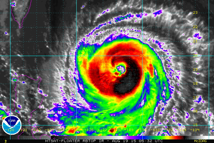
Specifically, a recurving typhoons like Trami, is often a sure sign of a deep trough developing over North America the next week. On the heels of deadly Typhoon Trami, Japan will face another dangerous typhoon this week. Super Typhoon Kong-rey is currently the equivalent of a Category 5 major hurricane in the Atlantic and east Pacific and will remain a dangerous tropical cyclone in the coming days. It is also recurving to the northeast towards Alaska. This is not a direct cause-and-effect relationship – the typhoon doesn’t cause the North American trough, but there is a linkage. The typhoon pumps heat into the ridge commonly found to the northwest of Japan. This in turn causes a trough to dig in over the Bering Sea, which builds a ridge over the Gulf of Alaska and British Columbia.
Finally, a trough begins to dig in over central North America, paving the way for colder air to move south. You can think of it as a domino effect. Each weather pattern is different, and the relationship between typhoons and troughs isn’t always perfect. The time period it affects North America is often 6-9 days if this system recurves over or east of Japan but can be nearer 14 days if it recurves further west towards China. This should lead to a Central and Eastern US trough and another taste of fall, perhaps even a taste of winter is possible late next week somewhere between the 11th and the 16th of October as a result of these recurving typhoons. The heat won’t give up without a fight. This atmospheric battle will lead to severe weather, flooding rain, heavy snow and potential for blizzard conditions in the northern plains. Severe weather may extend down into the Mississippi Valley. One thing is certain…it will be an interesting and wild month of October.