


Veterans Day is an official United States public holiday, observed annually on November 11, which honors military veterans; that is, persons who served in the United States Armed Forces.
It coincides with other holidays, including Armistice Day and Remembrance Day, celebrated in other countries that mark the anniversary of the end of World War I; major hostilities of World War I were formally ended at the 11th hour of the 11th day of 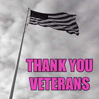 the 11th month of 1918, when the Armistice with Germany went into effect. The United States previously observed Armistice Day. Congress amended the bill on June 1, 1954, replacing “Armistice” with “Veterans,” and it has been known as Veterans Day since.
Great Britain, France, Australia and Canada also commemorate the veterans of World War I and II on or near November 11th: Canada has Remembrance Day, while Britain has Remembrance Sunday (the second Sunday of November). In Europe, Great Britain and the Commonwealth countries it is common to observe two minutes of silence at 11 a.m. every November 11. In the United States, an official wreath-laying ceremony is held each Veterans Day at the Tomb of the Unknown Soldier in Arlington National Cemetery, while parades and other celebrations are held in states around the countr y.
y.
Veterans Day is not to be confused with Memorial Day—a common misunderstanding, according to the U.S. Department of Veterans Affairs. Memorial Day (the fourth Monday in May) honors American service members who died in service to their country or as a result of injuries incurred during battle, while Veterans Day pays tribute to all American veterans—living or dead—but especially gives thanks to living veterans who served their country honorably during war or peacetime. If you are marching in one of the local Veterans Day parades on Saturday, the weather will at least be reasonable. It will be chilly but dry. A cold front is expected to arrive by Saturday night along with rain.
But the parades should be over before the rain gets into the region. We continue to see cold fronts arrive every 3 or 4 days and each one brings another shot of chilly air. Then it warms a few degrees before the next front arrives. In order for the  cold air to dig in and to last longer than a few days, two things need to happen. One, there has to be blocking in the area of Greenland to hold it in place. Then there needs to be a buildup of a snowpack in Canada and the northern Plains. This would tend to keep the cold air coming into our region from modifying…or warming as much. This is what seems to be currently underway in the pattern right now. But it will be a gradual process and won’t happen overnight.
The period around Thanksgiving may be one to keep an eye on as far as any frozen precipitation is concerned. It probably won’t be a big deal but it may be a sign of things to come. While December may see some active weather, I am watching the 23rd or 24th for a potential wintery/snowy situation. 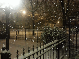 Another one a few days after Christmas may also need to be watched. But the one that everyone seems to be keeping any eye on is in mid-February. It is a long ways out, but there are “things” pointing to that as a particularly powerful storm.
This doesn’t mean there won’t be other potential snow and maybe ice events throughout the winter. But those three seem to continue to stand out in the long range outlook. So in the meantime, we will continue to see more back and forth temperature swings that will become more extreme as we get into December. At the same time, there are signs that blocking patterns are about to set up which would bring better chances at seeing wintery weather as well. It is going to be interesting to see how things finally play out, especially as we get into December. Stay tuned. If you enjoy reading this post, feel free to leave comments and be sure to hit the “Like” button at the bottom.